Wednesday, August 27, 2014

Mornington

We love Mornington and chose to spend four nights here, so that we could take the exclusive canoe trip up the Sir John Gorge. Only one canoe is allowed on the gorge per day, so you have the whole place to yourselves.

The first day we spent at Dimond Gorge and then Cadjeput Waterhole, where we swam. Not a soul about so we took the opportunity to skinny dip, as we have in many places. It is nearly the end of the tourist season, so places are emptying fast! There are very few visitors left.

The next day was very slow, we swapped camp sites, closer to water and bbq facility and did a much needed laundry session - all by hand.

We then ventured out to Bluebush Waterhole, to find that the only place easily accessible to swimming had been taken over by a group of young people. So we went back to Cadjeput Waterhole, where a busload of tourists and a group of seven tag-along drivers were enjoying the water. We found another spot some distance away and again enjoyed our swim (this time with bathers!)

The third day was our adventure into Sir John Gorge. We set off with a hamper, prepared by the wilderness camp's restaurant. This day proved to be exhausting!

We had been assured that the walks between each water hole to retrieve the next canoe were on flat rock ridges. This proved to be far from the truth. The signage was almost non existent and the walks were over boulders often taller than me!

Photos can do more justice than my words........


We felt quite exhilarated with our accomplishment at the end of the day.


Mt Elizabeth Station

From Home Valley Station we travelled to Mt Elizabeth Station, dropping in at most of the gorges on the way.

30klms off the Gibb River Road, Mt Elizabeth is not normally frequented by international tourists, so if you chose to camp away from the ablution block, was very quiet and tranquil. The Pretty Wallabies are unafraid and one came to investigate our camp set up.

Mt Elizabeth is a working cattle station, on which they were completing their annual muster by helicopter. Owned by the pioneering Lacy Family, it is welcoming and an enjoyable place to visit.

We discovered that there were a number of tracks on the property that you can take, right into the wilds of the Kimberley and to the Walcot Inlet, on the north west coast. Included in this was a little known gorge called Wunnumurra Gorge. We drove to the gorge, a mere 9klms, which took 1 1/4 hours. The road in was very challenging over rock ledges, ridges and sand. The effort was well worthwhile as we had the most spectacular gorge to ourselves for the whole day! Deep pool below a cascade of water with white beach at the other end of a very long expanse of water.


It was quite hairy walking to the gorge as we were reluctant to drive the last kilometer or two to the walking path (another kilometer), due to the extremely steep boulder strewn track, where we feared hitting the differential on loose rock. The walk included scrambling over and down rock faces, with two ladder climbs on unsecured ladders. We thoroughly our well earned swims!

Unfortunately my camera ran out of power so no other photos, had to get the station to recharge battery!

When we returned from our drive out to the gorge, we noticed a Double cab Triton with Travelander camper on the tray. The only trouble was that the tray was at a 20degree angle off horizontal to the cab. It transpired that the chassis had buckled on their drive out on one of the station tracks some 42 klms from the homstead. This required, the station to send a rescue party and their friedns returning with their now empty ute teay to collect the abandoned camper. Then a tow truck was ordered from Kununurra and took eight hours to reach the homestead. Who knows what the insurance will make of this??? The owners of this infortunate Triton were Rob and Joyce Stocker from Albury, who knew Don and Janice very well.

We met some interesting people at dinner that night, when we dined at the homestead. Brian and Jane were two medicos who had worked in and established a hospital in Zambia. They had owned a private practice in Humptydoo in Darwin and wereavid bird watchers. Their friends were called Allen and Pam. All had just returned from Mornington after a bird count.


El Questro

On our last trip to the Kimberley, we did not call into El Questro. It was on fire and that was when the cross country marathon runners got very badly burned.

Because of the smoke at that time we were not even aware of the magnificence of the Cockburn Ranges. Having just toured right around this range on the Karanji track, we now knew what an awe inspiring place this is. It meant going back east along the Gibb River Road to be able to visit some of the places of interest.

At El Questro Station, we purchased a Wilderness Park Permit, which all visitors must do, if the want to see any of the gorges or do any of the walks. As Zebedee Thermal Springs closes at noon to allow their "exclusive" guests to lounge in the water, we decided to go there first.

The walk into Zebedee Springs takes you through a Livingstonia Palm forest as well as dry scleraphyl savannah. You wander alongside the creek with its almost blue water, its so pure, until you reach the springs.


To begin with it was very crowded with a Wilderness Tour group ensconsed in the spring. Soon they left and then the springs had very few people. It was heavenly to soak in the 32C water, especially where there was a small waterfall to give you a natural massage.

We had asked at the reception at the station which walks would be the most siitable for Peter, whose knees are really painful and not working properly. She recommended Zebedee Springs and Emma Gorge. So off we headed to the Emma Gorge Resort and nearby gorge.

A couple in a deluxe motorhome asked us if we had done the walk before and warned us of how difficult it was. We headed off, thinking that they had exaggerated somewhat. We had walked about a third of the way, when the track started to become very stony and rocky, with unstable boulders and loose, slippery stones. Peter reluctantly decided to head back.

This proved to be very wise because not much further along, meant scrambling over huge boulders, slippery rock ledges and deep water crossings. The further I progressed, the more difficult became the track. The final leg was very steep up the rocky sides of the ravine. All along the last sections of the track, you got tantilising glimpses of what might be to come. Ferns and mosses grew beside the clear stream.

The last scramble over a massive boulder revealed Emma Gorge in all her glory! A magnificent cathedral like dome with deep clear water pool below, eighty foot waterfall dropping from red cliffs, showers dripping from the carvern roof above, lone cormorant sunning on the rocks and ferns and mosses with small ficus clinging to the walls of the gorge. The water was very cold, but just behind a massive boulder on the eastern edge of the pool and underneath the overhang was a thermal spring. Unfortunately I had left my bathers at the car.


We stayed the night again at Home Valley. There was a group of people on an escorted fishing safari, on the banks of the Pentecost River, when we arrived at the campsite. Whilst we watched, one of the rods bent in half and started to be dragged into the river. The chap, whose rod it was, had gone back to his campsite to get his esky. So the fishing guide grabbed the rod, called for "Bazza to come quick" and manouvered the fish away from any potential snags. We saw this enormous fish jump twice, right out of the water. By the time Bazza arrived it was in the shallows by the shore, so that he could take the credit of catching it, even though a net was held there by the fishing escorts. It turned out to be an 80cm barramundi. It was right on the maximum size that you are allowed to take.


Flight to Kalumburu, Mitchell Falls

Shoal air offered a scenic flight called Wandjina Explorer. It departed from Kununurra and tracked along the Ord River with its irrigation farmlands towards the unigue House Roof Hill, where much of the movie 'Australia' was filmed. We continued along the Ord River wetlands and estuary, passing the historic port of Wyndham and the Cambridge Gulf where the five major rivers of the East Kimberley converge. We then followed the Timor Sea coastline, north-west, flying over the Berkeley River and its new award winning resort. Next we detoured to the magestic King George Falls (not running!), orbiting the twin falls. Faraway Bay, another famous resort was next in sight, followed by the Drysdale River and Broome-Dampier Bay. We landed in Kalumburu, WA's most remote indigenous community for a picnic lunch and a tour of the museum at the Catholic Mission, followed by a tour of the WWII aircraft graveyard near the airfield. The flght then continued to the historic Truscott Airfield, our first line of defence in WWII. We then viewed the pearl farms of Vanssittart Bay, before flying over the famous Mitchell River Falls. En route back to Kununurra, we enjoyed the panoramic splendour of the Cockburn Ranges, Home Valley and El Questro Stations.

The flight to Kalumbaru and Mitchell Falls was a sensational way to see the north east coast of the Kimberley (the section we didn't get to see on our One Tide boat/camp cruise in 2011!)

Needless to say it surpassed all expectation with the magnificence of the scenery. And as we flew for much of the way between 1500 and 2000 feet, we saw the area from a bird's perspective, in all its glory.

The photos will perhaps, show more that I can describe!

New Ord River irrigation area, bought by the Chinese for sugar cane!

Ord River - old crossing.

Mud flats leading to the Cambridge Gulf.

East Kimberley coast

Mitchell River and Plateau

Mitchell Falls

Beach near Paspally pearls

Honeymoon Bay


WyndhamC

Many people suggested that Wyndham was not worth visiting. It is indeed a dusty town and boasts the highest average temperatures in Australia including Marble Bar. We enjoyed our visit, despite the fact that everything was closed.

The Once-a-year races were on the day we went resulting in a RBT, on the edge of town.

A "must do" is to go to the Five Rivers Lookout. Here you can see, on land, what we had seen from the air, the five great rivers of the north east Kimberley; the Durack, the King, the Ord; The Pentecost and Forrest Rivers merging and then flowing into Cambridge Gulf, creating a massive wetland and gulf.

Below the lookout it was possible to see the Old port with its now defunct meat works and croc farm.

We drove to Three Mile Creek to find it burnt out with not much to see.

On the Wyndham Jetty a young aboriginal man had caught a massive catfish weighing at least sixkls on a handline. The struggling fish had made the fishing line cut into the man's fingures.


Parry Creek

Parry Creek Farm Tourist Resort

Salt water croc in lagoon

Moochalabra Dam


Aboriginal Art site


Boab Prison Tree


Diggers Rest


Kurunjie Track

Two young women, we had met at Lake Stretch highly recommended doing the Kurunjie Track. After visiting Digger's Rest Station, we drove through the gate onto the track. This track takes you through several private properties, including Digger's Rest and El Questro and around the northern and western sections of the Cockburn Ranges.

This proved to be a stunning visual experience, with the afternoon sun shining on the Cockburn Ranges. Deep reds, orange and purple hues highlighted the massive cliff faces and as we passed very closely to this massive rock formation it was awe inspiring.

The track involved driving along part of the King River Road, across salt and mud flats. The track was not that well marked and is not maintained, but for the most part was a fairly reasonable road.
Whilst only about 65 klms it took most of the day. The track ends at the Pentecost River crossing. We were delighted that we had taken this route.

A camp at Home Valley Station was the resting place for that night.


Kununurra and Lake Argyle

A laundry stop became a matter of priority, we were down to our last pair of undies. Fresh supplies was also a priority, so we headed to Kununurra.

This is great town, full of friendly people with heaps to see and do whilst there. We stayed in a local caravan park and early next morning went to visit some of Kununurra's highlights.

First stop was the Hoochery, a whisky and rum factory. Our favourite was a magnificent, smooth aniseed rum. The owners grow their own aniseed with which to flavour the licquer. The aniseed is brewed with the rum and the final product is a clear, brigh green spirit - delicious!

Next stop was the Sandlewood Factory. Acres and acres of Indian Sandlewood is grown in the Ord River irigation area. TFS not only own acres of sandlewood, but also manage the acres of other growers. We didn't know that sandlewood required a host tree on which to grow. So between each tree a host tree is planted.

We also visited the Zebra Rock Gallery, which produces artifacts and items out of rock called Zebra rock due to the very vivid stripes contained in it. A visit to Oria Orchards provided us with much needed fresh produce.

At the campsite in Kununurra we met a charming couple, Ray and Craig from Nhulumbouy. They were having a much needed rest from their jobs at the bauxite mine and were taking small trips from a " home" base in Kununurra to places of interest around. We really enjoyed their company.

Lake Argyle. Here we spent one night enjoying the scenery. We went back to Kununurra after this so we could get up early for our flight to the Mitchell Falls.

Hydro scheme at Lake Argyle, near Ord River dam wall.


Purnululu NP

Purnululu NP is known by most people as the Bungle Bungles. This a spectacular national park and a World Heritage area. The road in has a reputation for being one of the worst in Australia. Many, we met, concurred with this. We found the roads however to be in very good order with some small corregations. Anything with duel axle and most caravans are forbidden to enter the national park.

The drive in takes you through Mabel Downs Station, a vast cattle station that has permanent water. You drive through five wet creek crossings in the way of Mabel Springs, Frank River, Bellburn Creek and Calico Springs.

We arrived early enough the be able to visit the north section first and visit the highlights of Echidna Chasm, Stonehenge, The Bloodwoods and Kungkalanayi Lookout.

The Kungkalanayi Lookout, gave us some perspective of the park as it was close to the middle of the park. From here you can get some sense of the geological formations that comprise Purnululu NP.

The northern part comprises escarpments with deep chasms, gorges, cliffs and deep valleys. The southern section is what the Bungle Bungle Range are renowned for; its striking banded domes, the world's most exceptional example of cone karst formations. They are made of sandstone deposited about 360 million years ago. Erosion by creeks, rivers and weathering in the past 20 million years has carved out these domes, along with spectacular chasms and gorges creating a surreal landscape.

The domes' striking orange and grey bands are caused by the presence or absence of cyanobacteria which grows on layers of sandstone where the moisture accumulates. The orange bands are oxidised iron compounds that have dried out too quickly for the cyanobacteria to grow.

Echidna Chasm

It is the home to more than 600 species of plants and more than 149 bird, 85 reptile, 32 native mammal and 12 frog species.

Unfortunately the wretched cane toad has now made its way to Purnululu and threatens the existence of many of these animals. In Walardi camp 40,000 cane toads were captured in 2 months. We met a guy who had gone on just one nights hunt of just two hours and in that time caught more than 400 toads!

These were some of the amazing places we visited during our two night stay at Kurrajong camp: Echidna Chasm; Stonehenge; The Bloodwoods; Kungkalanayi Lookout; The Domes; Picanniny Lookout and Cathedral Gorge.

We met a group of Dutch travellers, three couples each driving off road camper vehicles. They had had some trying experiences with equipment failing, car breakdowns and fridge problems. All of which had eaten into the precious little time that they had to spare for their holidays.


Friday, August 8, 2014

Wolfe Creek Meteorite Crater

A leisurely start to the day with a swim in the lake and an easy, short drive from Lake Stretch allowed us to arrive at Wolfe Creek Metorite Crater early in the afternoon.

The crater stands out from the surrounding desert plains, a rusty red rim of scoria and small boulders, different from the sand around it. We expected a dry and dusty campsite, but were surprised to find that there were shade trees and greenery all around.

It is only a short walk up a gravel path to the rim of the crater. Signs ask you to not climb into the crater, but most people ingnored these, to clamber down to the inside of the crater over loose boulders and rubble. At the bottom the crater has filled with sand over the millenia. In the centre was a round circle of small green trees and white sand.

Wolfe Creek Meteorite Crater was created some 300 million years ago, by a meteorite hitting the earth's surface. The crater was originally 120 meters deep, but now, due to the sand being blown in from the surrounding desert plains, is only 20 meters deep.


Gregory Lake System

We needed directions out of Mulan, so called in at the local clinic. This new facility was spotless and very well maintained. Indeed the whole of Mulan had little or no rubbish and was well cared for.

The road around the Gregory Lake system is just two tyre tracks, mostly over red and orange sand with a few small stony sections. Some ten klms out of Mulan we pulled in to Handover Camp site, one of three sites reserved for tourists to camp. The lake is quite a distance from the camp. The camp had new toilets and huge shady red gums. This campsite is situated on the largest of the lakes (known as Yampirri Yampirri) and is brackish.

We decided to proceed on to the next campsite known as Yunpu. The muster had just been completed and this is where the drovers had camped. The site again was spotless, with new composting toilet, makeshift shower cubicles and fire pit. No one was about, so we had the area to ourselves. Shady melaleucas grew from the white sand and gave shade during the day. A great place to camp.

The drovers had left some excellent logs for the fire, so we had a roaring fire over which we could boil water and create excellent coals for our camp oven. This night we cooked up the crocodile mince, purchased in Alice Springs and had it with vegetables. What does it taste like??????

We think it tastes like a mixture of chicken and fish, very mild.

In the morning we walked down to the lake, known locally as Palpaly, to collect water for a shower. Birdlife abounded on and around the lake. This was also raptor heaven. We counted at least a dozen Wege-Tailed eagles soaring in the skies over the grasslands. Two magpies swooped at and harrassed a young eagle, who was forced to land on the ground a couple of meters from where we were sitting having breakfast. He looked totally perplexed by us and by his situation of having to land in such an undignified way. When it finally flew off, the other eagles also left.

The road out towards the Canning Stock Route from Yunpu had been recently graded, as had the final 125klms of the Canning Stock Route leading to Billiluna. The trucks carrying the cattle from the recent muster had necessitated this occurence. We heard people conversing on the cb radio who were travelling that route from south to north, and soon we caught up with them. They had taken 17 days to complete their trip. A little while later, a convoy of another three vehicles came at us going the opposite direction.

The Canning Stock Route convoy, related a story to us about a mad Dutchman! This fellow had flown in from Holland and was riding his bike along the Route! He had been told in Holland before he left that he could get water from all the wells along the way. The old wells were evenly spaced apart to allow the stockman to get to the next source of water with their cattle in a day's drove, approximately 30klms. Of course, this young man didn't bother to get any local information before setting off into one of the harshest environments on earth, and carried just enough water to take him 50 klms per day! Now, only eight of the original fifty one wells are operational, so here he is, in the Great Sandy Desert, without enough water to get him from water source to water source. The Route is 1619klms long. Thankfully there is plenty of traffic on the route, so he has become reliant on the good nature and generosity of others to survive.

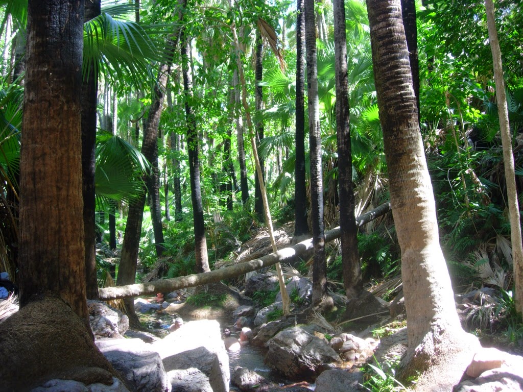
Two nights at Lake Stretch, some 15 klms south of Billiluna is a great treat! Clean fresh water, birdlife in abundance and time to rest the body from all the corregations and dust. The bush campsite again was clean and well maintained.

We had the area to ourselves, the first night, bar two motor bike riders, one of whom had limped along the Tanami Road, and who had been abandoned by his other motor bike friends, when his bike started to give trouble. These so-called friends also abandoned another of their crew after he fell off his bike and broke his collarbone, because he was travelling too slowly!
The second night, two lovely young women came to camp, Aria and Kirsty. They had both completed a year-long motor mechanic course at TAFE, which comprised of 22 days of full 8 hours work and included some bush mechancs. They were travelling by themselves in very remote areas, with spares and recovery gear. We thought they were very enterprising, highly capable and very interesting. They had been on the road since March.